-
Posted: April 20, 2017Categories: GardeningRead more »
April is generally the first month when you can actually start working in the garden again with some degree of comfort. It's great to get back outside in what is finally really warm Spring sunshine.
It's a really colourful month too ~ spring flowering versions of azaleas, rhododendrons & magnolias all start to come out. Time to feed the plants too. You should fertilise most annual, perennial and flowering shrubs and trees with a good plant food which will release nitrogen, potash, iron and other micro-nutrients slowly over the next few months to help the plants growth and overall development. Evergreens and deciduous shrubs and trees can be fed now as well with tree and shrub food, again it'll slowly release the above nutrients to help the plants development. If you have planted anything new this season use a starter plant food (preferably at the time of planting) so root growth is encouraged.
Freshly mulch flower beds: you may want to add a
-
Posted: April 07, 2017Categories: CommunitiesRead more »
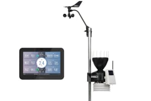
Weather-Watch is a specialised forum for users of weather station software and in particular for the Weather Display family of products.
It is a UK base site but has more than 8,000 members world wide who between them have generated over 504,239 posts. Weather-Watch was started 10 years ago by Chris McMahon who manages it today with a team of moderators. Chris is also one of the developers behind MesoMap Live.
Follow the links bellow for a list of recent posts on particular subjects:
-
Posted: March 20, 2017Categories: GardeningRead more »
March is the month when the Spring bulbs are out and start to give a good show. If you were on the ball and planted plenty of bulbs at the end of last year when the garden was looking dead and rather wet then the large amounts of sunshine in February (though not excessive warmth) may have helped push your displays on into bloom.
However, this is not the case everywhere by any means, as it is not really the amount of sunshine at this time of the year which brings the bulbs on. The temperature of the air and soil is the deciding factor, along with a good supply of moisture in the ground- though not too much. If anything the ground has actually been a little too dry recently, with the lack of expected rainfall in most parts. As I have mentioned regularly in the last few weeks in the 'blog' I put together here, although it was exceptionally sunny in February (East Anglia saw over twice the average sunshine it would normally expect for example) it was also
-
Posted: November 01, 2016Categories: GardeningRead more »
November already and as we lose an hour with the clocks back to GMT times for another six months, it now seems to darken very early. I used to worry, as a very young lad in late October, if it would be dark enough for fireworks at 7.30pm (my usual bedtime) by November 5th, but it always was! Something else I recall is that by then we would have gathered up huge piles of leaves ready to burn on the nights bonfire but recently many trees still seem yet to have shed their leaves by this date. So are we really seeing later leaf fall or is my old memory playing tricks?
Well, official research does seem to suggest that over the last thirty years, leaves have started to change colour and fall later in the year, a phenomenon that scientists now attribute directly to rising levels of atmospheric carbon dioxide.
Gail Taylor from the University of Southampton and her colleagues studied the growth and leaf fall of Populus trees (a genus which includes the poplar
-
Posted: September 05, 2016Categories: RetrospectivesRead more »
Monthly retrospective for August 2016
The month was slightly above average temperature wise but rainfall was again variable due to the showery nature of the precipitation although very dry in places, and sunshine was near or somewhat above average- especially in the SE- but almost everywhere away from the far north.
The (Hadley) CET mean temperature was near 17.1C, about 1.3C above average with the mean minimum about 1.5C above.
Most parts of the north were about 0.5C above average but the south was generally a degree or more above average. The pressure was 2-3mb above average across the UK as a whole.
The warmest mean maximum was at Heathrow (Middsx) with 24.7C and the highest daily maximum was 33.9C at Gravesend (Kent), which was also the highest this summer.
The coldest mean minimum was at Aviemore (Highlands) with 8.9C, the coldest absolute minimum by night was at Dalwhinnie (Highlands) with -1.0C though some spots in this area were certainly a degree -
Posted: August 02, 2016Categories: RetrospectivesRead more »
Monthly retrospective for July 2016
The month was slightly above average temperature wise but rainfall was again variable due to the showery nature of the precipitation although very dry in places, and sunshine was again rather below average almost everywhere away from the far north.
The (Hadley) CET mean temperature was near 17.0C, about 1.0C above average. Most parts of the north and west were very close to average but a few parts in the east and SE were over a degree above average. The pressure was 2-3mb below average across the northern UK but a few millibars above in the south.
The warmest mean maximum was at Gravesend (Kent) & at London Heathrow (Middsx) with 24.0C and the highest daily maximum was 33.5C at Brize Norton (Oxon).
The coldest mean minimum was at Eskdalemuir (Dumfries & Galloway) with 9.6C, the coldest absolute minimum by night was at Altnaharra (Sutherland) with 0.5C.
June was generally a rather dry or very dry month in the
-
Posted: July 04, 2016Categories: RetrospectivesRead more »
Monthly retrospective for June 2016
It was another month that was slightly above average temperature wise but rainfall was again very variable due to the showery nature of the precipitation although very wet in places, and sunshine was below average almost everywhere away from the far north.
The (Hadley) CET mean temperature was near 15.2C, about 1.1C above average. Whilst a few places were very close to average many parts were over a degree above average, and a few parts of north & NE Wales were nearly 2C above. The pressure was near average right across the northern UK but a few millibars below in the south.
The warmest mean maximum was at Pershore (Worcs) with 19.6C and surprisingly the highest daily maximum was 27.8C at Porthmadog (Gwynedd).
The coldest mean minimum was at Aboyne (Aberdeenshire) with 7.8C, the coldest absolute minimum by night was at Resallach, of -0.1C in the Scottish Highlands with -3C on the grass at Tulloch Bridge (Highlands) -
Posted: July 04, 2016Categories: RetrospectivesRead more »
Monthly retrospective for May 2016
It was quite but not especially a warm month temperature wise but rainfall was very variable due to the showery nature of the precipitation although wet in places, though sunshine was very close to average again, as in April in the main for most parts.
The (Hadley) CET mean temperature was near 12.5C, about 1.4C above average. Whilst nowhere was below average many parts were only just above average. The pressure was near average right across the UK.
The warmest mean maximum was at Heathrow (outer London) with 18.9C and surprisingly the highest daily maximum was 27.7C as far north as Plockton in Ross and Cromarty.
The coldest mean minimum was at Aboyne (Aberdeenshire) with 4.6C, the coldest absolute minimum by night was -5.7C at Tulloch Bridge in the Scottish Highlands with -9C on the grass. This was the lowest temperature in May for 4 years.May was both a dry and wet month in places, Inverbervie in the Highlands
-
Posted: February 02, 2016Categories: RetrospectivesRead more »
February forecast synoptic summary
Week 1 from the 1st-7th February will initially see low pressures run northwest of Scotland and towards Norway with higher pressure across the south by the 3rd, but by the 4th a further deep low pressure system running across the north west by early on the 5th into the 6th and a secondary low deepening and possibly swinging NE across the south or Midlands and into the North Sea. By the 7th a chilly polar flow from the N-NW across all parts.
In week 2, from the 8th-14th a chilly polar maritime flow will dominate across all parts initially but further fronts into the west by the 9th as a low pressure system runs NE'wards across the northern UK on the 10th but with a colder PM flow behind it by the 11th, a blocking high pressure area may ridge north across the mid Atlantic for a few days at this time, but by the 13th its ridge maybe building into the NW and as it sinks south east on the 13th into the
-
Posted: February 02, 2016Categories: RetrospectivesRead more »
Monthly retrospective for January 2016
It was very mild but very wet in places in the north & west but rather dull too esp in the south. The (Hadley) CET mean temperature was near 5.7C, about 1.9C above average. A number of daily maximum temperature records were broken on the 24th & 25th and the all time high minima January records too, in Scotland, Wales & Northern Ireland.
January saw temperature anomalies range from about 2C above average in the far south to just below average in the far northern Isles. The warmest place by day was St Mary on the Scilly Isles with a mean maximum temperature of 10.8C. The warmest daily maximum was at Achnagart in the NW Scottish Highlands where 16.5C was reached on the 24th. The coldest mean minimum by night was 1.8C at Lossiemouth in eastern Scotland. Pressure was 2mb below average in the far northern Isles but 10mb below at Valley on Anglesey attesting to the unsettled nature of the month in the main.
January


